Geolocation Program Management (GPM)
Automating Infrastructure Projects Across Telecom and Utilities
GPM is a geospatial project management solution built by US Software Solutions to streamline how telecom, fiber, and utility networks are designed, deployed, and maintained. With full visibility across every project phase, GPM empowers teams to boost efficiency, reduce costs, and ensure compliance—on time, every time.
Construction & Civil Engineering
Industries Served
Construction & Civil Engineering
Centralized planning, design-to-execution tracking, and BIM-ready workflows for complex infrastructure builds.
Read MoreGPM Architecture
Seamlessly Integrated, Fully Scalable, and Geospatially Intelligent
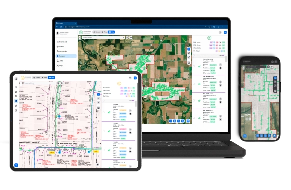
GPM is built on a flexible, multi-layered architecture that brings together industry-standard GIS and CAD tools into one unified platform. It enables real-time mapping, spatial analytics, and project visualization across devices—ensuring every stakeholder works with the same live data.


Geospatial Intelligence for Real
Real-time geolocation tracking, GPS-stamped field data, and centralized task visibility enable complete oversight across all phases of project delivery.
Accelerated Inventory Processing & Asset Control
GPM’s WYMS optimizes inventory intake, fleet movement, and equipment availability across yards and staging areas.
Live Project Intelligence in One Hub
All your project data—mapped, verified, and visualized in one place. Data Sphere is your centralized decision-making layer.
Proof-Based Billing & Compliance Automation
Built for financial accuracy, Payroll connects verified field data to structured billing and compliance workflows.
90%
Reduction in Reporting Errors
5x
Faster Project Completion
200%
Increase in Field Efficiency
Millions
Saved in Overbilling Prevention
Are You Interested?